
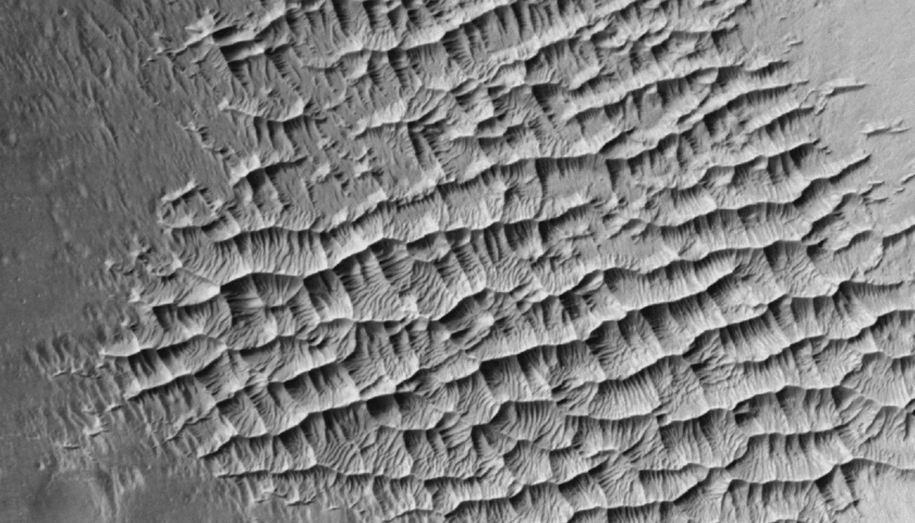
A field of ripples within a crater in Verde Vallis, an ancient river bed on Mars, 500 meters across.
It’s the ultimate in photography. You can tell the Mars Reconnaissance Orbiter (MRO) what to take a picture of using its High Resolution Imaging Science Experiment (HiRISE) camera.
Through a program running on the HiWish website, citizen scientists (planetary explorers?) are invited to offer suggestions on what areas of Mars should be the next to fall under HiRISE’s camera. HiWish has a map of Mars for your perusal to see what areas have been photographed more than a Lohan outside of a L.A. nightclub and also, which ones could do with a little more love from the lens.
You have to do some work and some convincing – pick your target and explain why that area is interesting, and wait to hear. With any luck, your choice will be one of the next for HiRISE to image. And remember – those first three letters of HiRISE stand for High Resolution Imaging, so the final images are nothing to sneeze at. For example – look dead in the center of the image below near the dark dot – see ’em? Those are tracks made by the Cuiosity rover. They disappear in the upper right of the image.
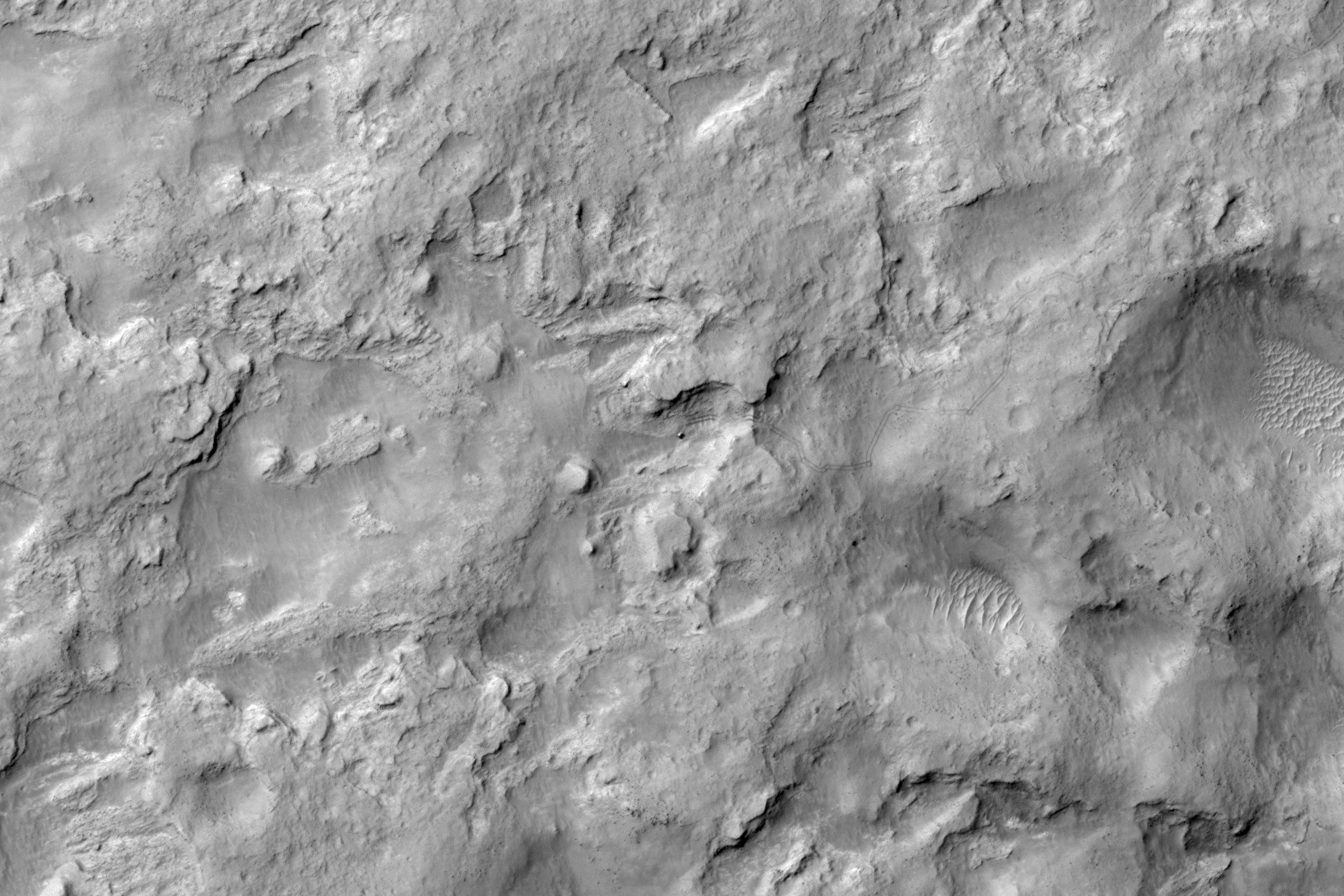
HiRISE view of Curiosity near Dingo Gap, sol 538
Fair warning though, there are thousands of suggestions ahead of yours, and some that may actually duplicate yours. Over at The Planetary Society’s Blog page, recent long-distance proxy photographer Bill Dunford (that’s his suggested image up top – of a dune field inside a crater in Verde Vallis, an ancient river bed on Mars) shares some hints on making sure your suggestion rises to the top of the stack:
1. Don’t go for something that’s been photographed a lot. The “face” in Cydonia? Skip it in favor of un-imaged areas that are compelling.
2. Go for an area that the MRO team is looking at. The website has a list, Dunford explains, such as:
Fluvial Processes – Images of channels, valleys, gullies, or other geologic features likely formed by erosion or deposition by water.
Future Exploration/Landing Sites – Attempts to find known spacecraft, or to provide imagery for upcoming landed missions.
Geologic Contacts/Stratigraphy – Images of bedrock exposed within crater central peaks or pits that reveal the stratigraphy at depth, as well as geologic contacts between distinct units/materials that can be used to infer stratigraphic relationships, such as relative ages or processes of deposition.
Volcanic Processes – Features produced by molten rock, such as lava flows, ash beds, cinder cones, and volcanoes.
Click the link above for more of Dunford’s hints and description about his experience as well as some spectacular images captured by HiRISE, or just go ahead on over to the HiWish page and start the process on your own.

This is not a picture captured by HiRISE. This is Wolla from John Carter. Still, an excellent subject for a photo.
Advertisement